✅ Georeferenziertes Rendering (Rasterbild) erstellen und als Web-Map publizieren mit Standortermittlung.
This link above shows the original repository with a detailed README with more material of how to create such a map in GIS on desktop.
Here are some new information provided about the render-pipeline and the raster-look.
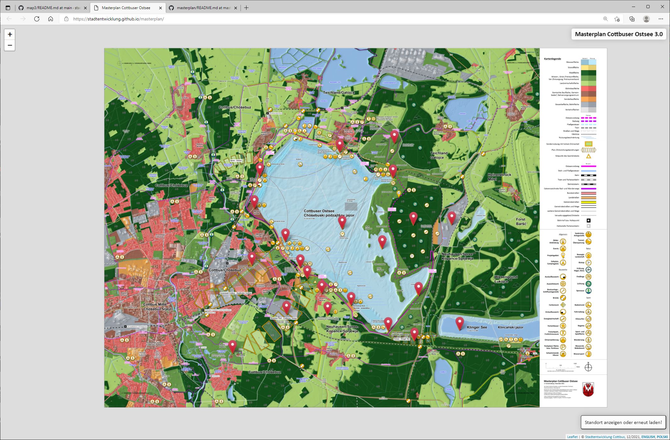
📸 Webmap 2.0: [https://stadtentwicklung.github.io/masterplan/]
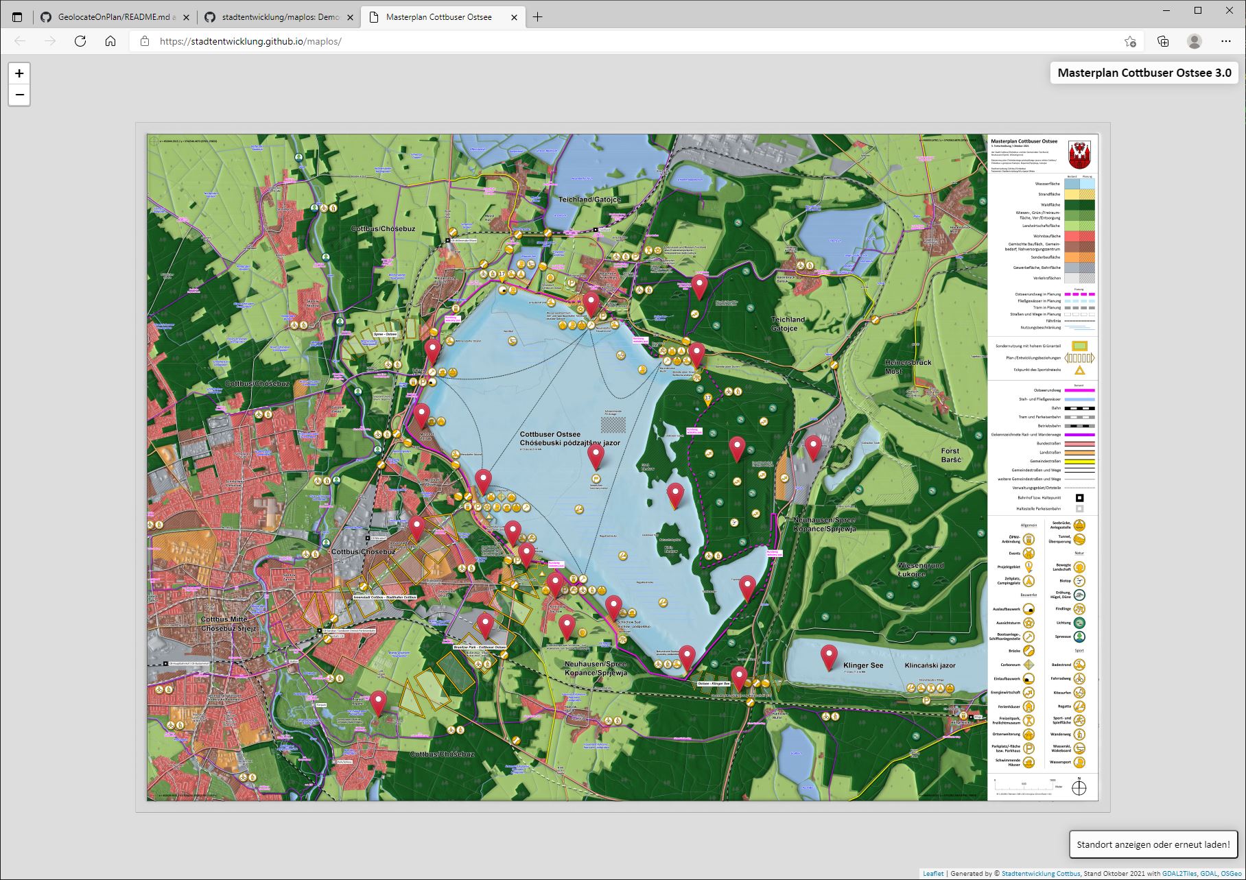
📸 Webmap 1.0: [https://stadtentwicklung.github.io/map1/]
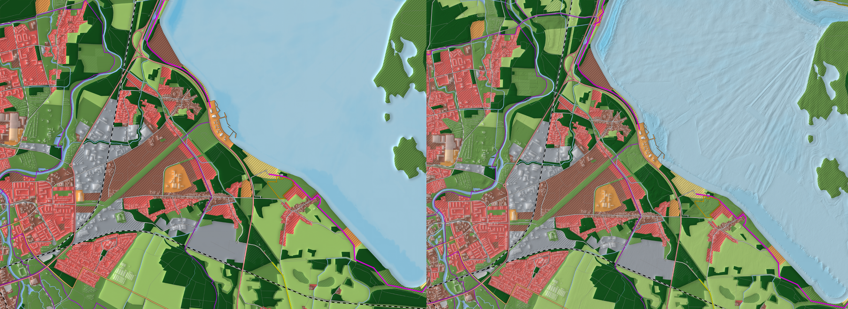
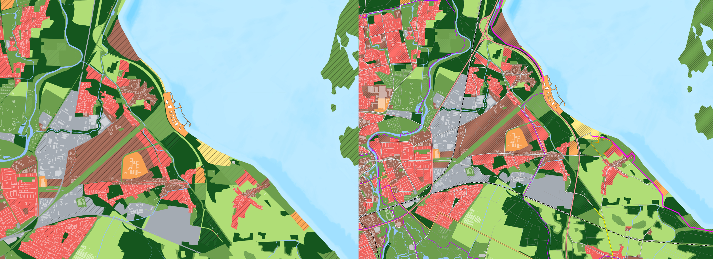
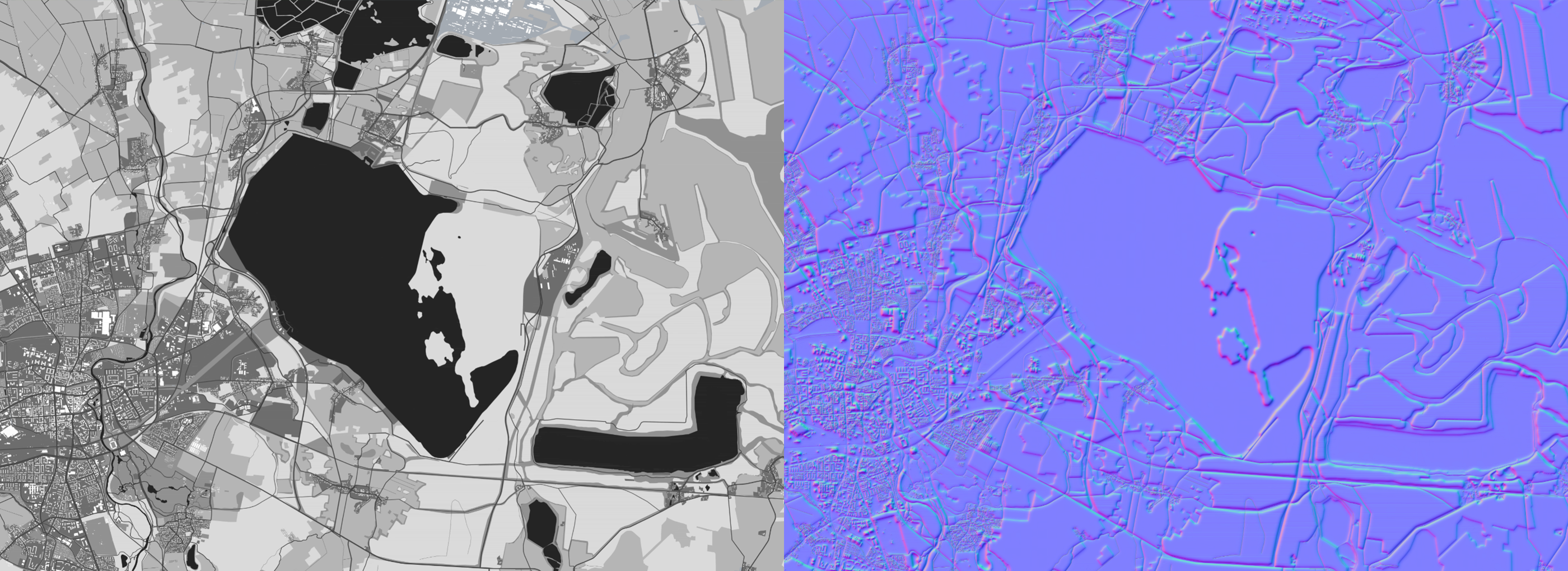
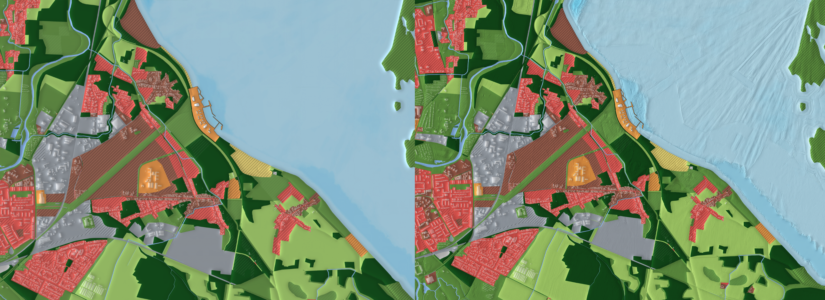
1. The original georeferenced vector plan is saved as a raster image (you can see a piece of the whole plan in two versions: (1) no streets and (2) with classified street infrastructure. (I wanted to know what looks better at the end: (A) streets from the vector plan on top or (B) streets included in the render-process.)
2. The next step is to organize the elevation maps for the render-loop. That are the files, which "bumps" the plan to a 2,5D-landscape, which can be logical illuminated with light and shadows. I found three possibilities:
- digital surface model (bDOM in german):
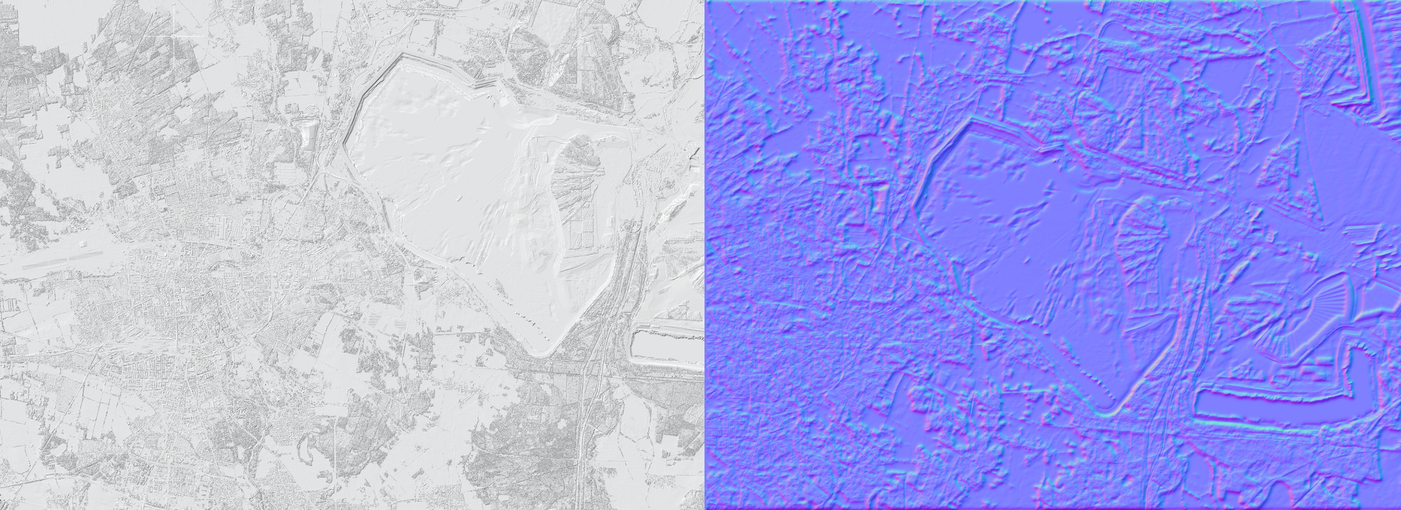
- digital terrain model (DGM in german):
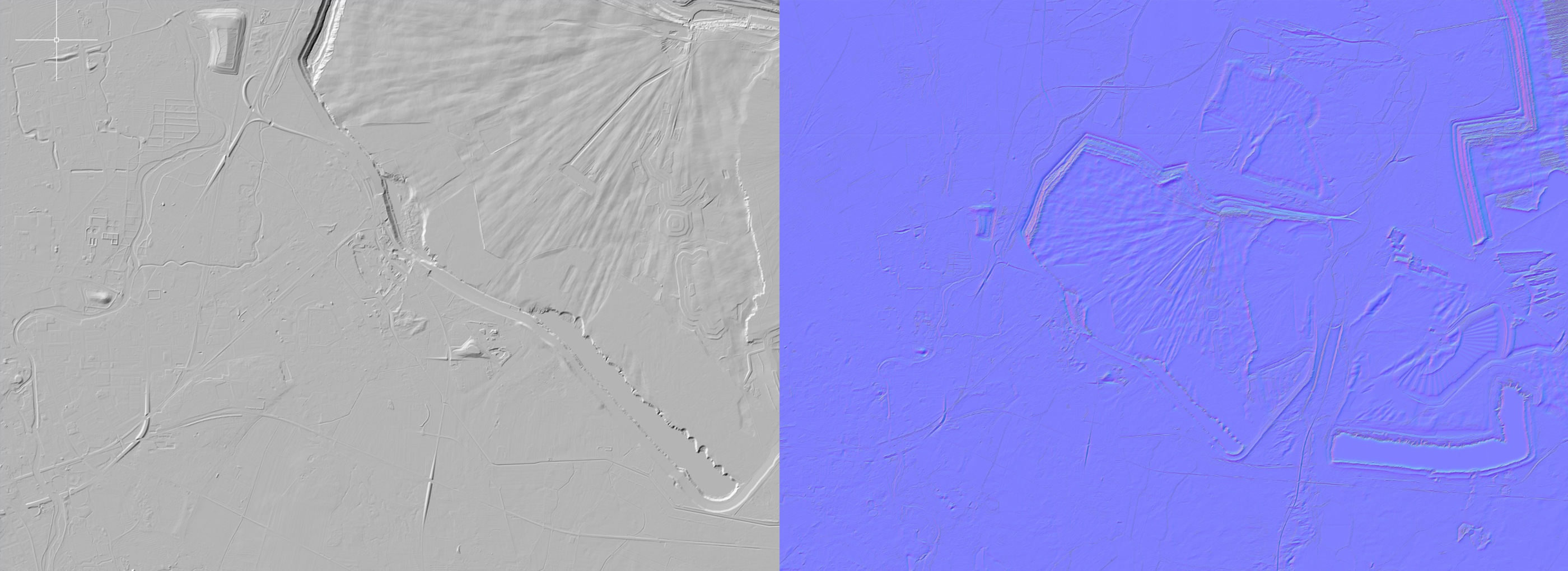
- making a manual generated model (MGM):
The MGM is a map in grey colors directly changed in the colored original vector plan. Photoshop transform all these pieces automatically in a "Normalmap" for elevation information. I wanted to find out which of these will bumps the plan best.
- Bumping with bDOM (left), DGM (middle) and both (right):
- Bumping with MGM (left) and mixed MGM with DGM (right):
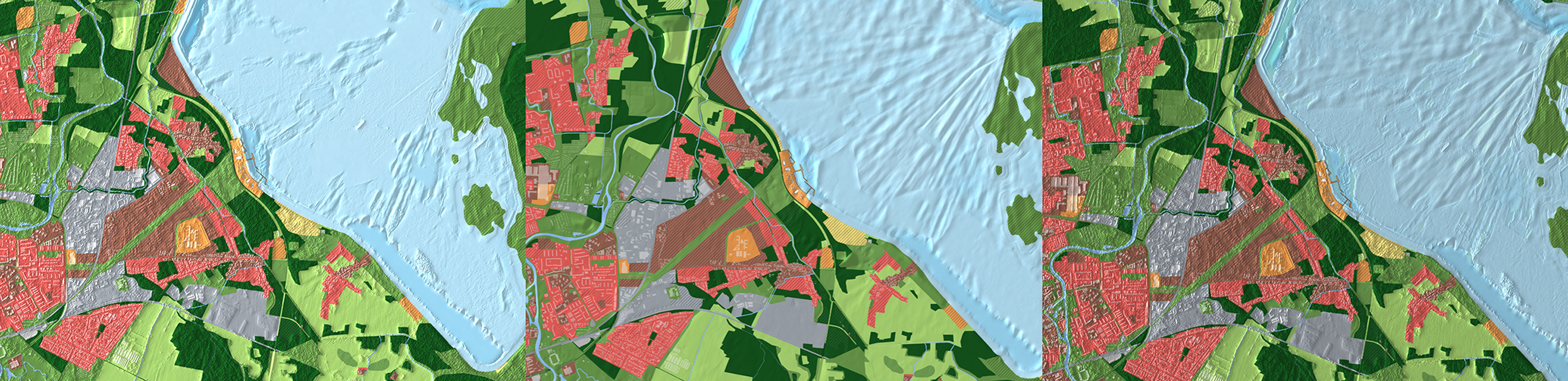
- Bumping the version with streets as mentioned above. The right result is the rendering of the final map: Buildings and streets has visible shadows because of the MGM, the surface has details because of the DGM.