A reusable Django app for raster datasets collaborative georeferencing. The typical use case is the environmental and administrative organizations paper archive digitalization.
- Many datasets with different settings, coordinate systems and basemaps.
- make use of GDAL/OGR library.
- Requires no Gis/desktop skills:
- simple control input
- visual feedback
- responsive interface
Required python libraries:
- django
- django-apps
- django-cors-headers
- django-http-proxy
- python-slugify
- django-imagekit
- django-raster
- pygdal
Required libraries: GDAL/OGR 2.0 http://www.gdal.org/
Last stable version:
pip install django-warpDevelopment version:
pip install django-warp- Add
django.contrib.gis,httpproxy,django_warpto yourINSTALLED_APPS - Define
MEDIA_URL,MEDIA_ROOT,STATIC_URL,STATIC_ROOT - Add
url(r'^warp/', include('django_warp.urls')),to urlpatterns in siteurls.py - Append
+ static(settings.MEDIA_URL, document_root=settings.MEDIA_ROOT)to urlpatterns. A minimalurls.pyshould be like this:
from django.conf.urls import include,url
from django.conf.urls.static import static
from django.conf import settings

urlpatterns = [
    ...
    url(r'^warp/', include('django_warp.urls')),
] + static(settings.MEDIA_URL, document_root=settings.MEDIA_ROOT)
./manage.py makemigrations django_warpand./manage.py migrateto create db context- Run server and browse to
[yourserver address]\warp\and login with a valid site credentials - First create a dataset with epsg code, extents and baselayer
- Then upload images and define correlation and clipping to do georeferencing
| CHANGELOG |
|---|
0.1 first release |
0.2 improved dataset manager |
0.3 setting epsg projection different from 3857 4326 issues fix |
| 0.4 new feature - download zipped collection of dataset georefs tiff along with .vrt file |
| new feature - auto pan/zoom on target/source view change |
can't clip raster issue fixed |
| 0.5 new feature - imagewms server for georeferenced datasets |
| new feature - display dataset coverage with internal imagewms server |
| new feature - overlay of all georeferenced datasets coverage from internal imagewms server in warp view |
| new feature - raster metadata edit in warp view |
| new feature - can move rasters between datasets |
| new feature - datasets cloning |
| accidental clipping polygon moving while panning in warp windows issue fixed |
border transparency in datasets coverage issue fixed |
0.6 update to Django 2.1 |
| ===== |
| SCREENSHOTS |
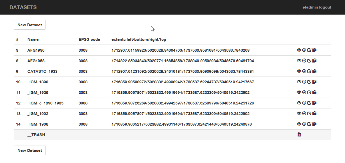
available datasets
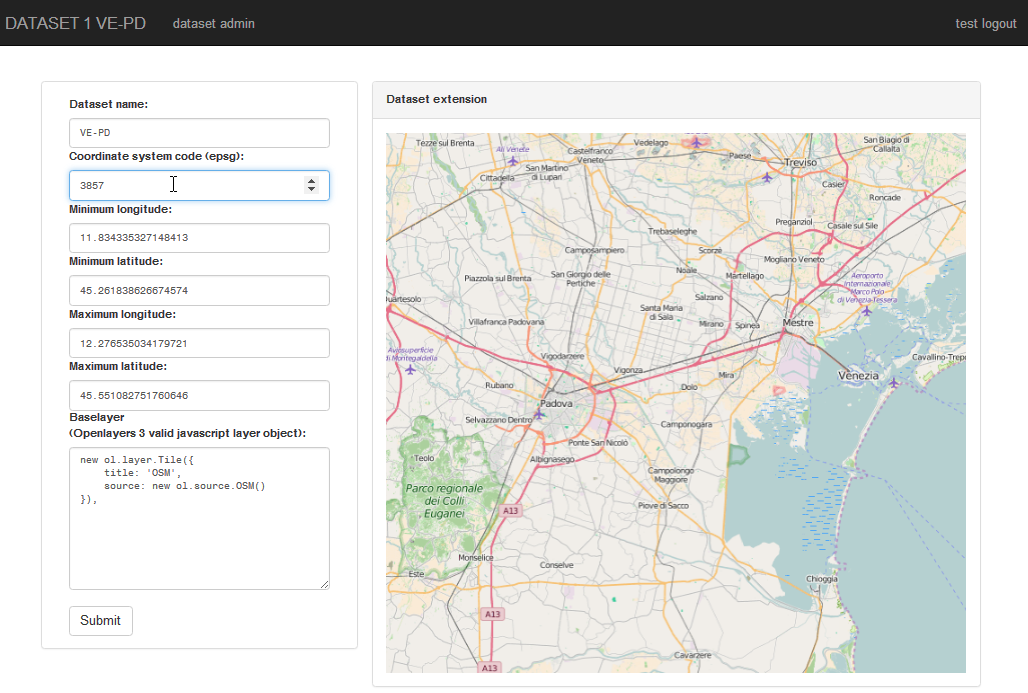
dataset setting, default to EPSG:3857 projection (web mercator) and OSM baselayer
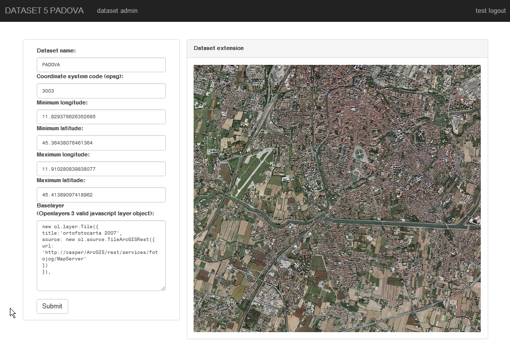
dataset custom settins: EPSG:3003 projection (web mercator) with ArcGis Mapserver baselayer
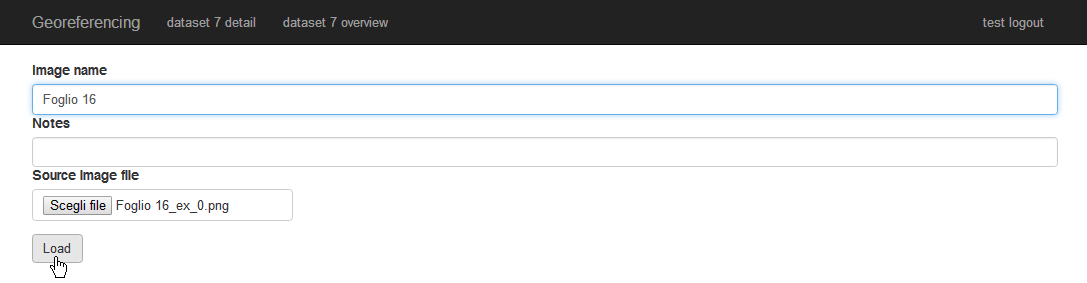
loading a new image
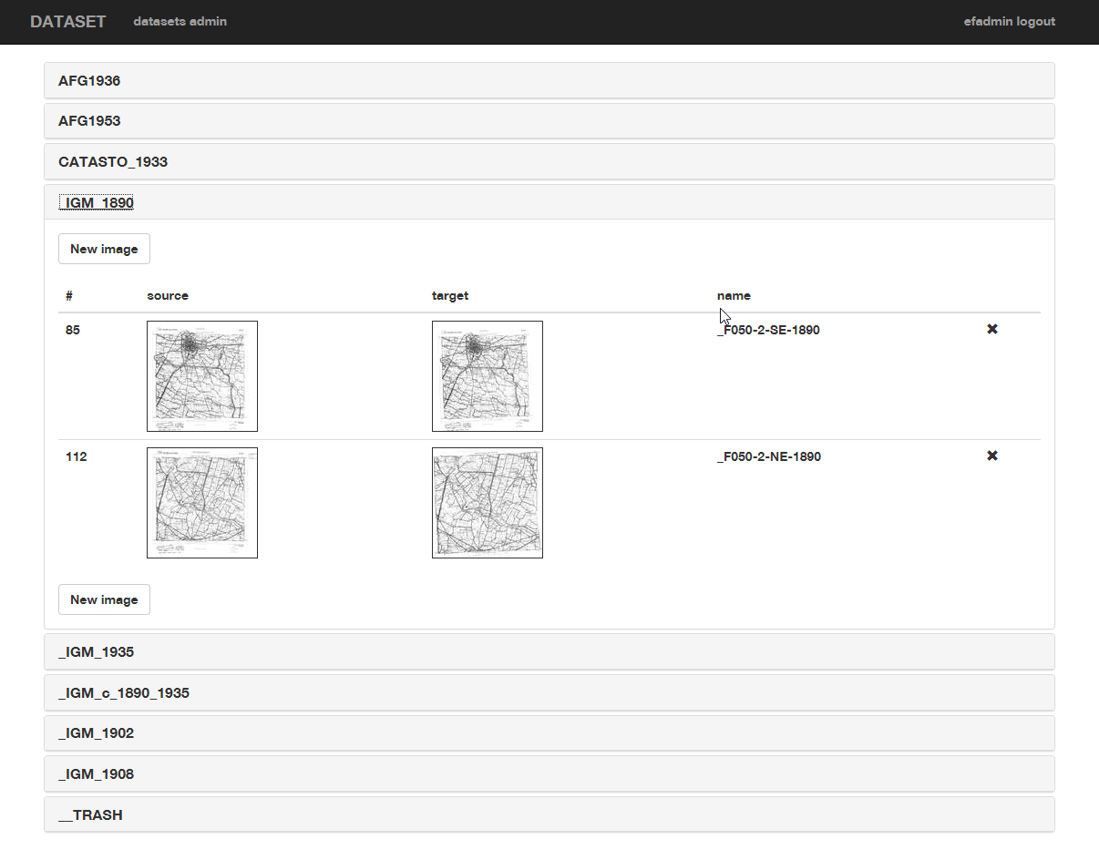
correlated available images in datasets
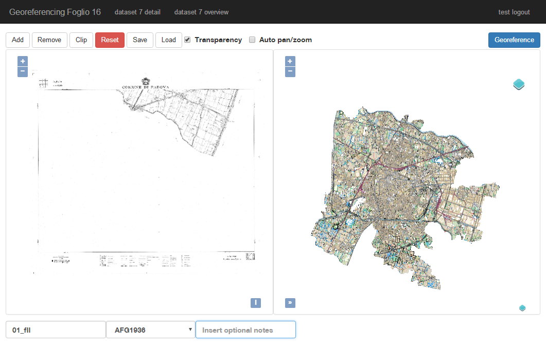
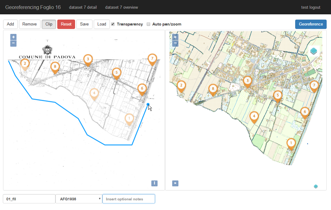
correlating source image on the left on target map on the right
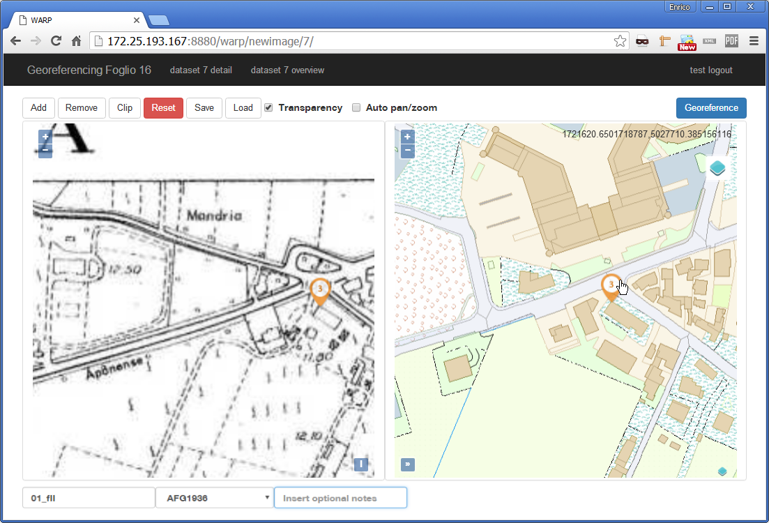
couple of correlation point on source image and target map
clipping source image
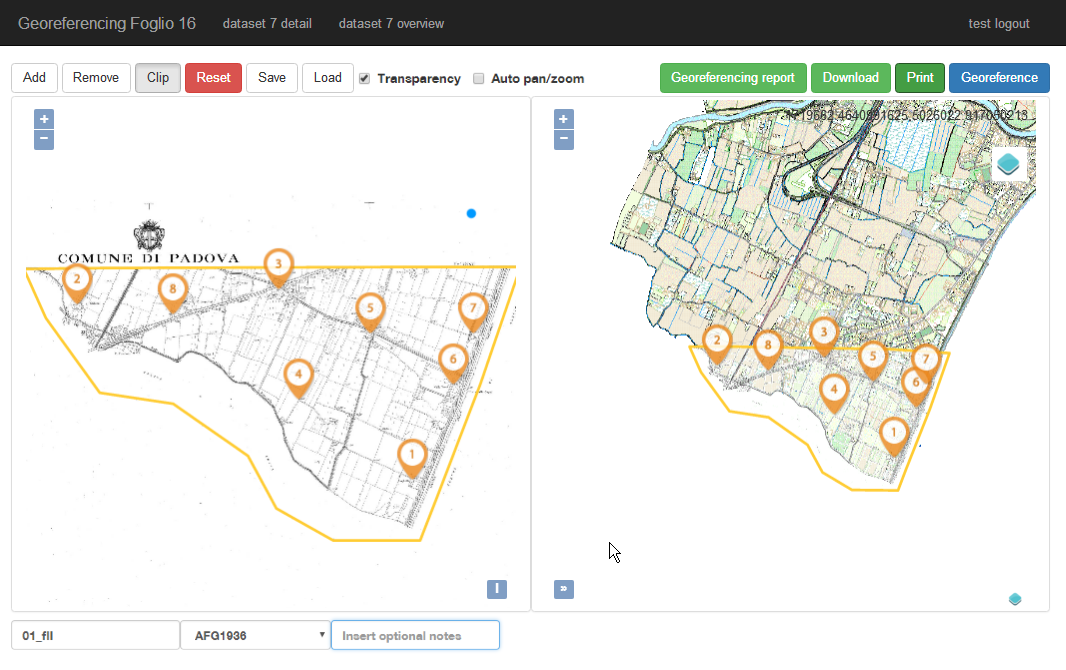
succesful correlation
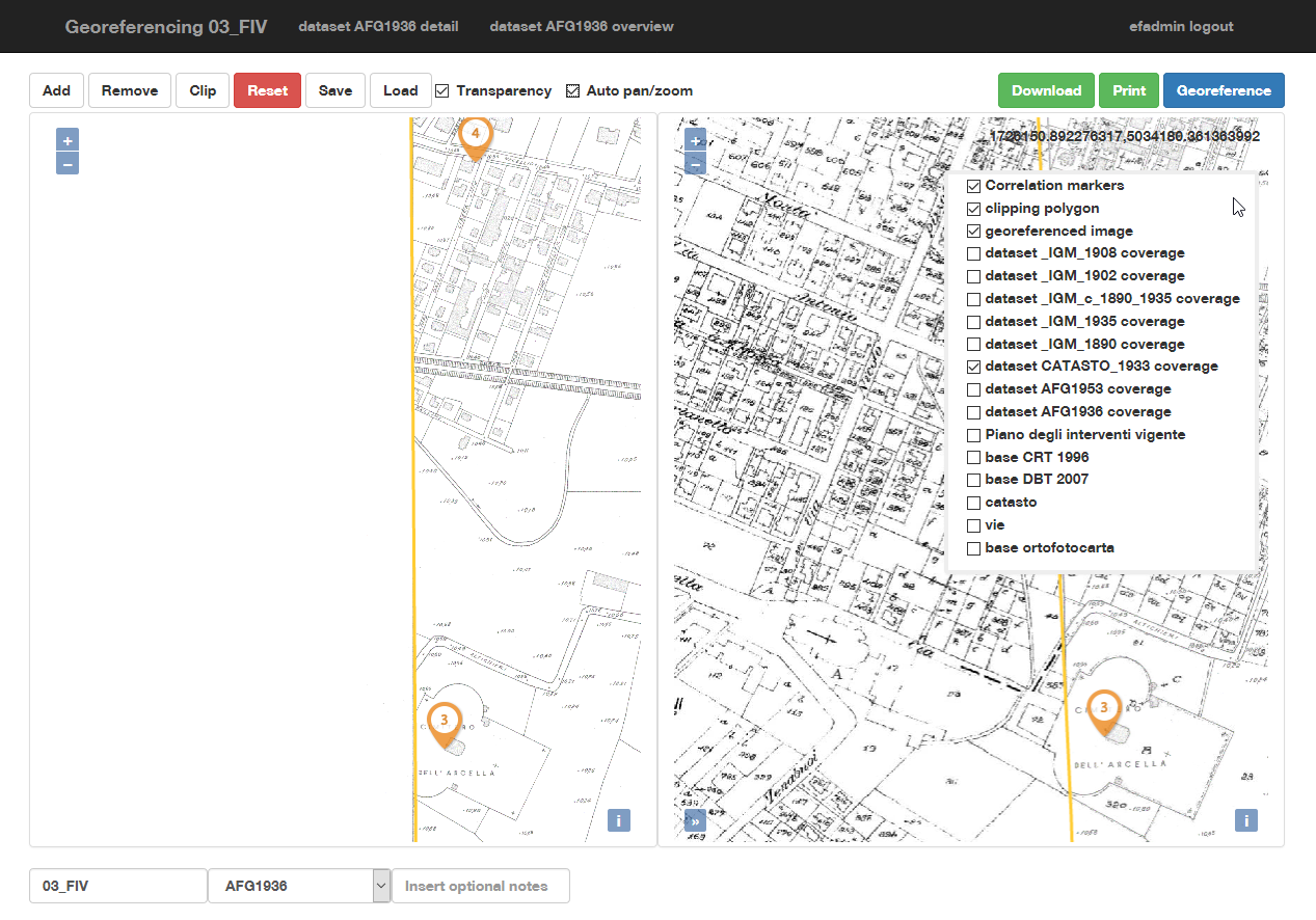
datasets coverage overlays in target map
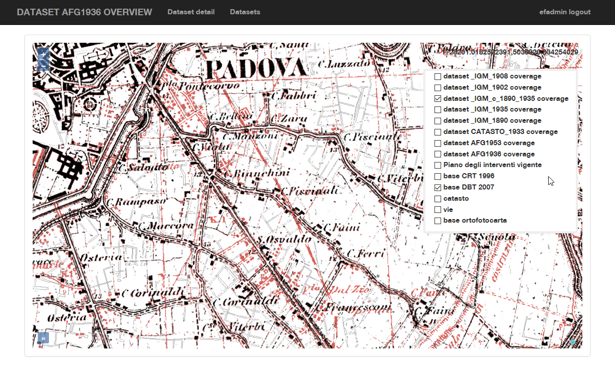
dataset overview with georeferenced images mosaic
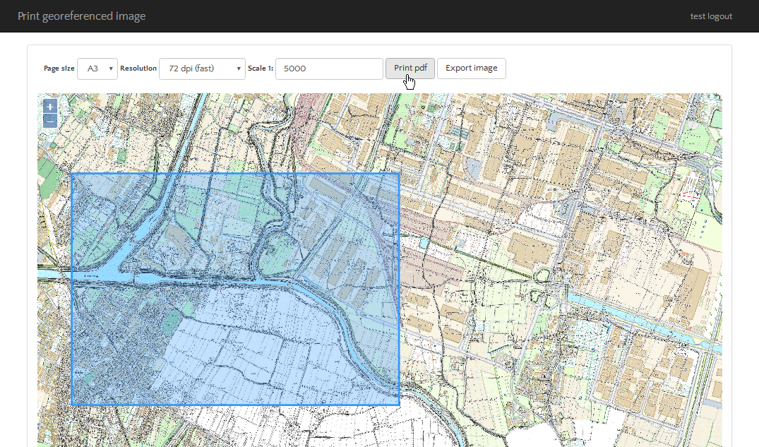
printing a correlated image